

Shipwreck Off the Coast of Alaska
Landslide and Tsunami
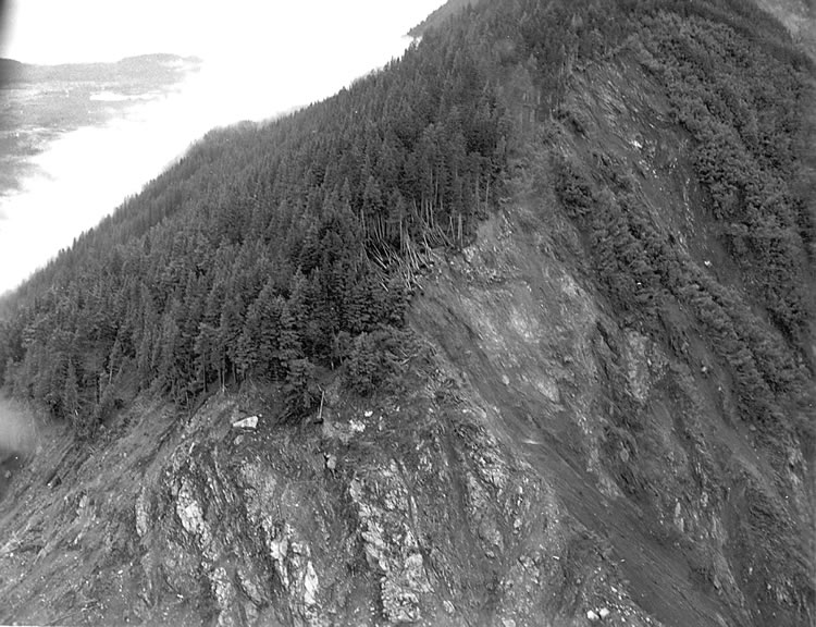
The destruction of the tree line as a result of the 1958 mega-tsunami. D.J. Miller, United States Geological Survey
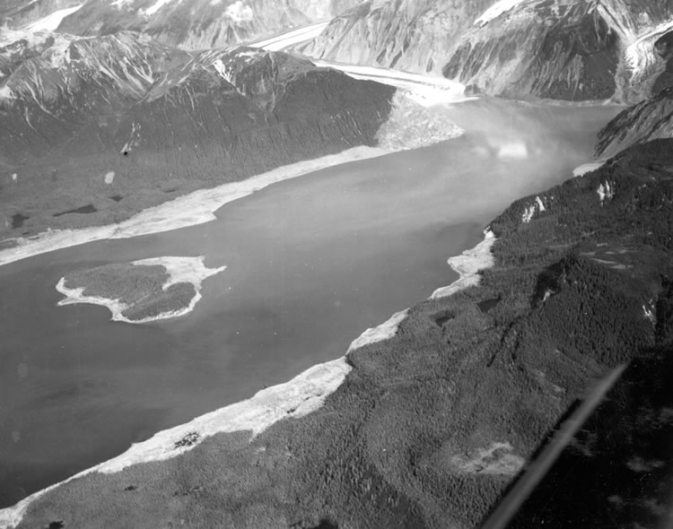
The waves fought by the La Pérouse expedition had a deadly power, but they were by no means the most violent Lituya Bay has experienced: in 1958, the bay was the site of the largest recorded mega-tsunami. A 7.8 magnitude earthquake triggered a rockslide into the bay, creating a massive wave over 1,700 feet in height. The power of the water stripped away the trees close to the coast, leaving a lighter-colored ring circumscribing the shore.
An animation by Dr. Stephen Ward of the 1958 rockslide and subsequent tsunami
Video (2014) showing aerial approach to Lituya Bay from the northeast, courtesy of Marc Onetto.
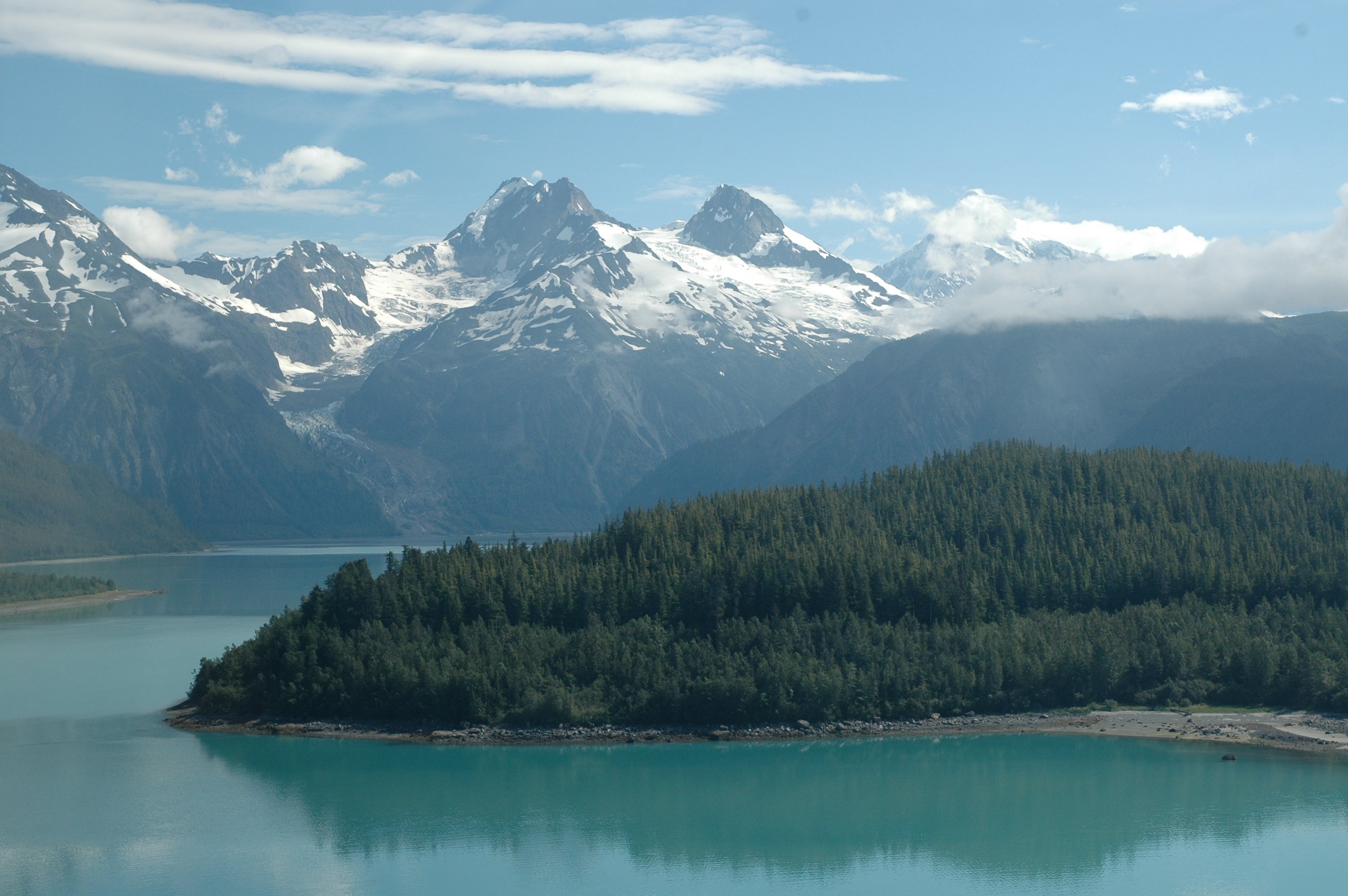
Lituya Bay today. Alaska ShoreZone Program NOAA/NMFS/AKFSC; Courtesy of Mandy Lindeberg, NOAA/NMFS/AKFSC.
Even today, evidence of the 1958 tsunami can be seen in the younger growth of trees which rim the base of the bay. The regrown vegetation has yet to reach the height of the trees not destroyed by the tsunami, leaving two distinctly visible layers lining the shore.